
Beaumont Neighbor Sources by Block
Public Beaumont sources answer narrow questions about a Beaumont block. The parcel viewer establishes geometry and an appraisal trail. JCAD supplies the owner of record and tax-contact fields. Recorded deeds for Beaumont property and plats explain ownership and lot layout. City maps add public administrative layers, while library material can place an older block in historical context. None of these sources supplies a confirmed list of all people at nearby addresses.
| Beaumont block source | What it shows about a Beaumont block | Access |
|---|---|---|
| JCAD GIS Online for Beaumont parcels | Adjacent parcels, parcel IDs, Beaumont mapped geometry, and an appraisal-search connection | Public map |
| JCAD Beaumont property roll | Owner, mailing and situs addresses, legal description, exemption and value fields | Free public search |
| Jefferson County deeds and Beaumont plats | Ownership chain, lot-block-subdivision detail, easements, and instruments | Portal, counter, and historic library index |
| Beaumont City GIS quick maps | Permits, code cases, zoning, floodplain, utilities, and wards | Public maps with an official-map limitation |
| VoteTexas and Beaumont Chapter 18 file process | Individual registration status or a statutory voter-file request path | Individual lookup or formal request |
| Beaumont Tyrrell directories and 1904 Sanborn | Historical address, street, building, and directory context | Library shelves or Library of Congress map |
Begin by documenting what each source actually proves. An owner record is about property, a mapped polygon is about location, and a historical Beaumont address listing is about an earlier entry. Those distinctions matter when looking at your Beaumont neighbors without making claims the records cannot support.
Map Beaumont Neighbor Parcels
The supported Beaumont block method is manual and parcel-based. Open the target address in JCAD GIS Online for Beaumont parcels, keep the same viewing scale, and select every polygon that shares a boundary with the target or fronts the same street. Record the Parcel ID, situs, and legal description for each one. Then search each identifier or address in JCAD to see the owner and mailing fields. This creates a record of nearby land, not confirmation of residents.
The JCAD GIS Online parcel viewer supplies the Beaumont map surface for the adjacent-parcel method.
Read the Beaumont polygons as map geometry, then verify owner and parcel fields in the appraisal record rather than treating the map alone as a neighbor list.
- Find the target Beaumont parcel and note its Property ID or Geographic ID, situs, and legal description.
- At the same scale, click each adjoining or fronting Beaumont parcel and record the same parcel facts before moving on.
- Open each Beaumont parcel in JCAD property search and record the owner of record, owner ID, mailing address, property type, and tax year separately.
- Use the legal description in Jefferson County Clerk records for a Beaumont deed or plat if a split, replat, or street variation makes an address difficult to follow.
No confirmed JCAD buffer or radius tool was located in the research. Manual map browsing is more accurate than claiming a preset distance. For the longer record chain along a named road, use the Beaumont street directory rather than extending a block review into a street-wide list.
Beaumont Neighbor Owner Records
Beaumont JCAD results can show owner name and owner ID, situs, legal description, Property ID, Geographic ID, property type, tax year, and value fields. The Beaumont situs is the assessed land or building location. The mailing address is where tax notices go. It may be a post office box, business, trust, estate, representative, or another location. Treat it as a Beaumont tax-contact lead, not proof that an owner lives there.
Use the Beaumont JCAD parcel result with the Jefferson County Official Records Search for Beaumont property when ownership history matters. Search the current Beaumont owner as grantee around the acquisition, save the legal description and recorded date, then search the seller as a prior grantee. Beaumont plats show subdivision, lot, and block layout. A map can help place a deed, but a deed's legal description is the stronger title reference.
For a Beaumont parcel note, save the Property Type and selected Tax Year with the owner result. JCAD currently offers Real, Personal, Mineral, Auto, and Mobile Home, and its Tax Year menu runs from 2018 through 2027. The JCAD data page marks the 2025 roll certified on July 21, 2025, the 2026 roll certified on July 20, 2026, and the GIS parcel data updated in August 2026. These Beaumont data markers help identify the version viewed, but they do not prove a current resident, a transaction date, or an active community connection.
Beaumont Neighborhood Associations
The City's neighborhood-association inventory is a community-contact layer, not a neighbor roster. Beaumont describes these groups as voluntary and independent, not city-managed. They are not HOAs and have no authority to impose fees or restrictions. Public meeting details can help someone find a legitimate local contact, but associations maintain any internal lists themselves and the city page does not publish member data.
Beaumont's association inventory provides the public meeting and contact information represented here.
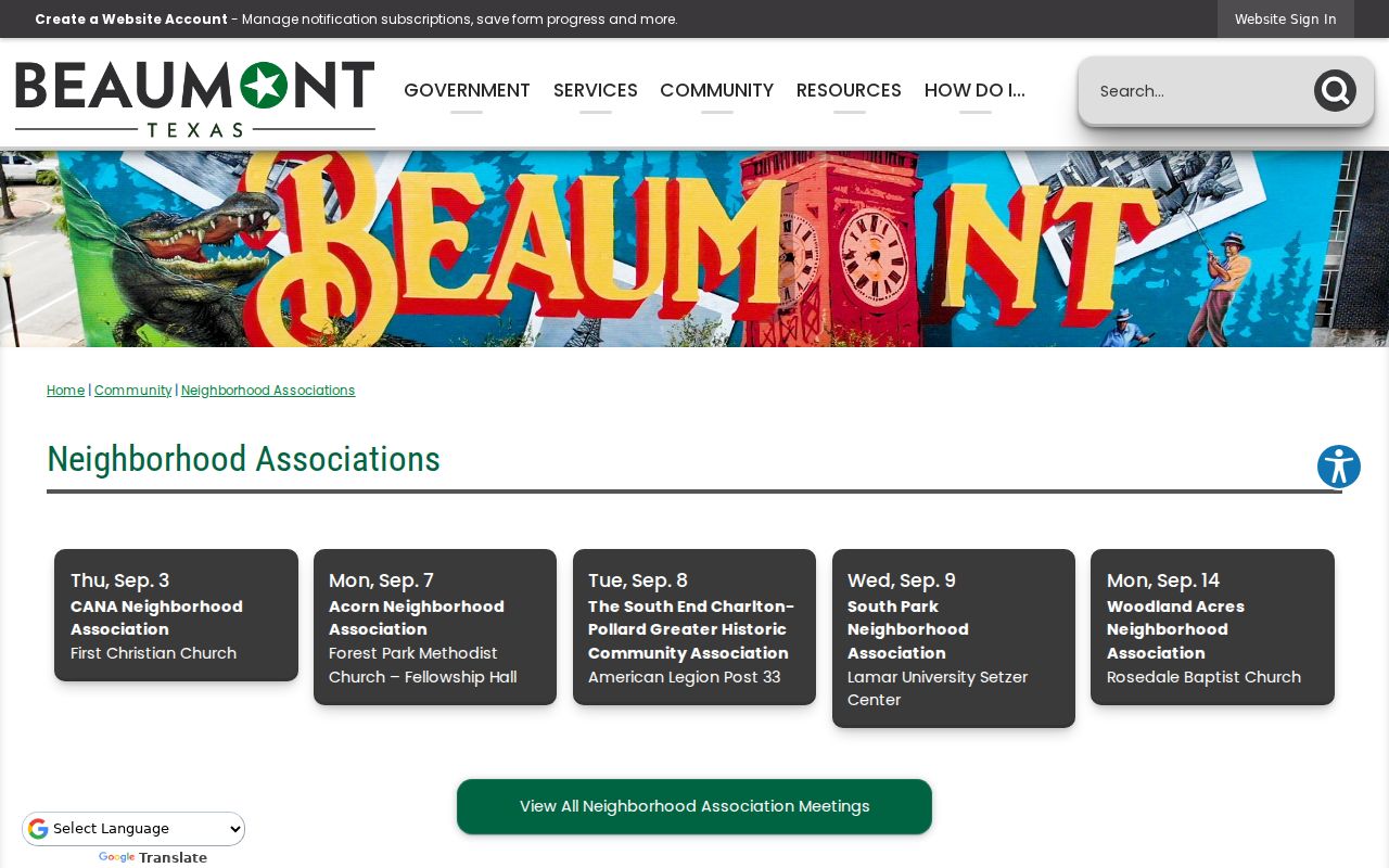
Meeting information can change, especially for a group marked inactive. Check the City listing or the group's public contact before relying on a schedule.
Beaumont's public association map includes more area names than the meeting table, including Brickyard, Cable, Caldwood, College Corridor, Heart of the City, Piccadilly Park, Pine Cone, Rockwell, Sallie Curtis, Treadway Place, and Tyrrell Park. A mapped area is useful Beaumont community context, but it is not an association roster or a verified boundary for every purpose. The City map itself carries an accuracy warning, so a current public contact remains the best check for participation details.
Beaumont Association Meetings
These are public meeting leads from the City inventory, not a directory of members. The list preserves the named area, schedule, venue, and public contact supplied in the research. Schedules are useful for community participation and local history questions, but they do not establish who lives on a particular block.
| Beaumont association or area | Public Beaumont meeting detail | Public Beaumont contact or status |
|---|---|---|
| Acorn | First Monday, 6 p.m., Forest Park Methodist Church | Doug Landry |
| Barrington Heights | Annual meeting in June | Verify current public contact |
| Calder Place | Third Tuesday of March, June, September, and December, Trinity UMC | Voluntary association |
| CANA | First Thursday, 6:30 p.m., First Christian Church | Tami Rhodes-Hathaway |
| North End | Fourth Monday, John Paul Davis Community Center | Katherine Campbell |
| Oaks Historic District / Old Town | Third Monday quarterly, McFaddin-Ward visitor center | Christina Crawford |
| Pear Orchard | Fourth Thursday, Theodore Johns Library | Delilah Johnson and Jeanette Rideau |
| South End / Charlton-Pollard | Second Tuesday, American Legion Post 33 | Chris Jones |
| South Park | Second Wednesday, Lamar Setzer Center | Dr. Wilma Jackson |
| Westchase | Annual meeting in January or February, Major Event Center | Verify current schedule |
| Woodland Acres | Second Monday, Rosedale Baptist Church | Carlton Sharp |
Beaumont Neighbor Group Status
Beaumont association status is a current-contact question, not a permanent label. The City inventory marks Fairfield, Meadows-Dowlen West, and Western Hills-Hidden Valley inactive. It also marks Willow Creek inactive, although a later City calendar lists a June 2026 Willow Creek meeting. Confirm Beaumont activity directly through the public City entry or current public contact before treating any group as active.
Public Beaumont contacts, meetings, churches, civic clubs, and historic groups can add local context. No public Beaumont-wide member roll was found. Do not treat meeting attendance, an organization name, or a group boundary as proof that a person belongs to a group or lives within it.
Beaumont Neighbor Map Context
Beaumont Interactive Maps offer address context beyond the parcel itself, including permits, code enforcement, zoning, floodplain, utilities, and ward information. Those layers can identify a topic to verify with a custodian. The City says the Beaumont interactive maps are nonofficial and may be incomplete. Request an official Beaumont map or full administrative file from the City Clerk through the Public Information Act process when the exact record matters.
The City map landing page shows the public map categories available for Beaumont neighbor research.
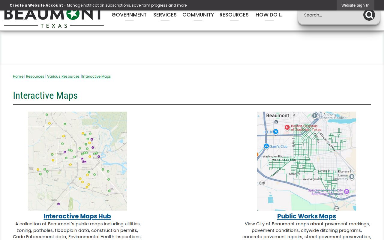
A Beaumont permit or code layer may point to a case number, address, owner or applicant, and date. It does not replace the official Beaumont case file or confirm a current household.
For a Beaumont official map or complete permit or code file, submit a written request through the Beaumont OneRequest Public Records Center, by mail, fax, or in person. State the Beaumont address, case number if known, record type, and date range. A phone call alone is not a Public Information Act request. OneRequest supports a guest request or an account for response history and downloads.
Beaumont Voter List Boundary
VoteTexas supports a Beaumont individual status check by VUID, Texas driver license number, or first and last name. It is not a Beaumont block-browse service. A full Beaumont voter-list request follows Texas Election Code Chapter 18 procedures, including the applicable request form, statutory use certification, and criminal-penalty notice. The request process is not permission to create a casual list of nearby people.
Protected Beaumont voters and Texas Address Confidentiality Program participants can have residential information withheld. Confidential fields also remain protected. A non-match or a suspense status does not establish that a person is absent from a Beaumont address. The Jefferson County registrar in Beaumont is the appropriate channel for an individual status question or a formal records route.
Beaumont Neighbor Tools Compared
Official records and commercial neighbor-search categories serve different purposes. A commercial category can combine property, marketing, and directory data, but it may conflate people with the same name, omit protected information, or lag behind the public custodian. Use official sources for the actual record question and community contacts for voluntary local participation.
| Source category | Best use | Limit |
|---|---|---|
| Official Beaumont parcel and deed records | Beaumont parcel location, owner of record, legal description, and conveyance history | Does not confirm residents or household members |
| Beaumont City maps and files | Beaumont permit, code, zoning, floodplain, utility, and ward context | Public maps are not official and can be incomplete |
| Beaumont voluntary association contacts | Public Beaumont meetings and a legitimate community contact | Not a member roster or parcel-by-parcel directory |
| Commercial neighbor-search category for Beaumont | General Beaumont comparison lead only | May combine stale or mismatched data and cannot replace a custodian record |
Historic Beaumont Block Evidence
Tyrrell Historical Library provides Beaumont directories, the Jefferson County deed index for 1836-1946, newspapers, and local history material. A directory's street section can place a past Beaumont address entry in a particular year, but the research did not confirm a separate reverse-directory run. The Beaumont directory record begins in 1903 according to one library source and is described as 1904 to present in a 2026 newsletter, so the shelf and exact volume should be checked before drawing a date conclusion.
The Library of Congress' 1904 Beaumont Sanborn map has 26 sheets. It can show a Beaumont block's building footprint, use, construction material, and street setting at that time. It cannot identify ordinary current neighbors. Combine it with dated Beaumont deeds and directory entries only when researching the historical block.
Beaumont Neighbor Privacy
Beaumont renters, household members, utility customers, delivery information, unlisted telephone data, protected voter addresses, ACP addresses, and exact current occupant status remain outside the normal public parcel map. A Beaumont tax mailing address has a narrow purpose. It should never be turned into a claim about someone else's present location. Keep personal Beaumont research focused on the record and the lawful question it can answer.
Lawful use. Use Beaumont block records for personal research, family history, property questions, civic context, or getting to know a community through its public meetings. Texas Penal Code Sections 42.07 and 42.072 address harassment and stalking; do not use records to watch, harass, intimidate, or harm anyone.